Near the end of last year we began a new world geography plan and completed North America, I even shared the free printables here. Over the summer I did some revaluating and realized we needed a simpler plan this year, so I got to work. I chose a new book, made a new set of printables and am thrilled with the new plan!

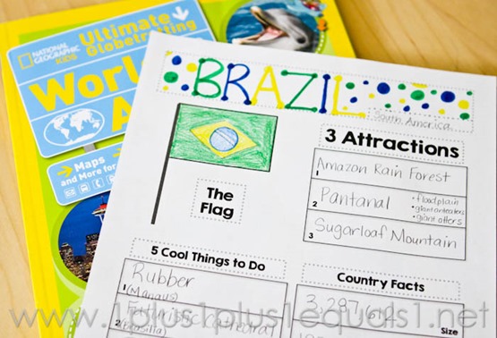
Instead of making a different printable for each and every country, I made a blank notebooking page that can be customized for each country we study! The new book I chose to use is the National Geographic Kids Ultimate Globetrotting Atlas.
Here’s a video walking you through my thoughts behind the plan {it was just too much to try to type out}…
There are a few different notebooking pages offered and the video explains why. There are also several map options, thanks to this awesome website!
We started last week and this went SO much better than our previous plan. So far I love this like I loved our country cards using the book Passport to the World which you can see here!
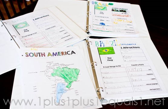
I chose to begin with South America and we learned about Brazil first. The kids colored it on their printable map, drew/colored the flag, and wrote in the country facts the first day.

My original plan had us completing this in one day and I soon realized I was overly ambitious. We ended up doing the 3 attractions the 2nd day, and the 5 Cool Things to Do on the 3rd day. All together we spent about 10-20 minutes per day and finished Brazil in 3 days.
I write the facts up on our large dry erase board and the kids copy the board to fill in their sheets. I found that giving them time to copy it all and THEN discussing it worked better.
This is Ladybug’s page, she is in 1st grade. She does a lot of drawing, it’s cute!

My kids are in 1st, 4th, and 8th grade. This is a shot of their pages from the first week.

My plan is to take about 3 days per country like this, maybe 2. I’d love to fit in 2 countries per week. I am not looking for deep knowledge, just a basic exposure to the world.
My Simple Geography Goals
- Find the country on a large map
- Identify the capital city
- Identify the continent the country is on
- Color the flag
- Know some key facts about the country
Download the Country Notebooking and Maps here!
Look for this graphic and click!


